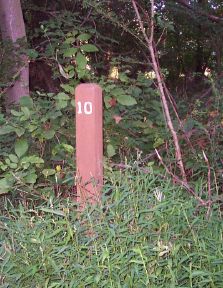
Milepost 10 of Rock Creek Trail stands beside the path just south of Veirs Mill Road, as the trail nears a set of soccer fields and Parklawn Memorial Park (a cemetery). This section of RCT crosses or follows park access roads as it passes over hills and through woods. Deer, rabbits, squirrels, and other creatures are often to be seen. After the milepost the trail proceeds via a sometimes-swampy area to Veirs Mill Road (busy street = DANGER!) and then zig-zags on neighborhood lanes until it returns to the creek at Aspen Hill Park. A good all-weather water fountain is located immediately west of the circular parking lot.
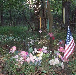
Approaching mile 11 is "Sue's Spot". This is a small memorial meadow on the east side of the trail created and maintained in memory of Sue Wen Stottmeister, local jogger and young mother who was murdered near here in 2001. By the bench in the glade are flowers and race medals donated in honor of Sue. (cf. SueWenRun, 29 May 2002)
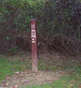
The trail around milepost 11 follows the creek closely, past dramatic rock outcroppings. Side paths lead to neighborhood streets. Fallen logs often exhibit bizarre fungus growth here.
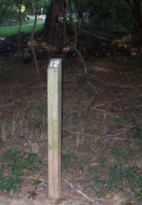
Milepost 12 is just south of Baltimore Road (DANGER! — fast traffic and poor lines of sight). The trail proceeds north and passes under Norbeck Road, where an all-season water fountain is available.
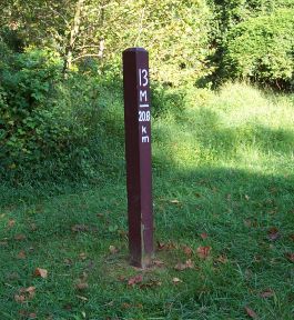
After milepost 13 the Rock Creek Trail includes two more hazardous street crossings (Avery Road and Southlawn Lane) before it begins the climb to its end. This section of the trail features nice bridges over tributary streams. Lake Bernard Frank and various nearby community recreation areas can be accessed via side paths from the main RCT.
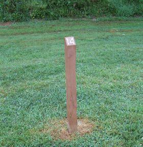
Here RCT curves away from Rock Creek, eventually to emerge from the forest to run beside large open playing fields to Milepost 14. A few hundred meters farther is a final water fountain near a parking lot at the southern end of Lake Needwood.
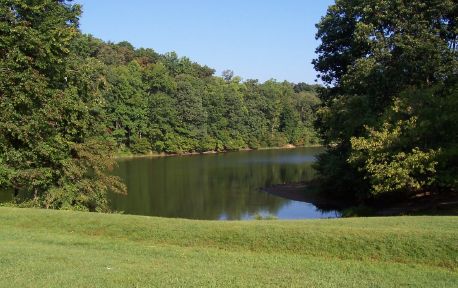
Lake Needwood, the end of Rock Creek Trail, was placid when this photograph was taken in August 2004. During late June of 2006, after days of heavy rain the lake rose dozens of feet and the earthen dam in the foreground began to leak. Several thousand people were evacuated until the water level could be lowered and the dam stabilized.
See [6] for a zoomable map showing the locations of GPS waypoints taken by ^z at every milepost along Rock Creek Trail, plus landmarks on other hiker/biker/jogger trails in the metropolitan area. Note that some map links in the image descriptions above have been tweaked to correspond to true milepost locations as depicted on Google Maps.
(photos taken by MarkZimmermann along RCT; cf. RockCreekTrail (31 May 2002), GoogleMapExperiments (11 Sep 2005), Rock Creek Trail Miles 0 to 4 (26 Sep 2005), Rock Creek Trail Miles 5 to 9 (16 Jan 2006), ...)
TopicRunning - TopicRecreation - TopicPersonalHistory - 2006-07-10
(correlates: Rock Creek Trail Miles 5 to 9, Rock Creek Trail Miles 0 to 4, RockCreekTrail, ...)